10 towns and cities, 20 passes, 170 kilometers, 1,200 years. Painting the Kumano Kodo Iseji Route by numbers offers barely a glimpse into the profound and formidable history of this ancient pilgrim path that connects two of Japan’s most sacred religious centers — the Ise Jingu in Mie Prefecture and the Three Grand Shrines of Kumano in Wakayama Prefecture.
Still, you can get some idea of what awaits you if you like the idea of an incredible, once-in-a-lifetime adventure and decide to head down to the Kii Peninsula to hike the route yourself.

Though the Kumano Kodo finds itself in the company of the only other World Heritage pilgrimage route on the planet — the Camino de Santiago in Spain — the Iseji Route portion in Mie Prefecture remains particularly uncharted territory among both Japanese and foreign travelers. Hardly changed since its conception more than a millennia ago, the route has a singular appeal not just for travelers to Japan but for anybody in search of real discovery.

That said the Iseji Route is not by any means inaccessible. In fact, the local governments of the Higashi-Kishu region are making a concerted effort to support modern-day pilgrims in their mission to conquer the routes themselves. Some English signage along the hikes, multilingual maps, and comprehensive tourism information all help to make the experience a safe and rewarding one.
Still, travelers will benefit from the proper preparation as the Iseji Route winds deep into misty mountainous Japanese backcountry, relenting only intermittently to a sleepy seaside town. This guide will show you exactly how to map out your own self-guided trip, whether you’re a seasoned hiker or a baby-soled first-timer.
The discovery part though is up to you.
Contents
History and background of the Iseji Route
A quick rundown of each of the 20 routes
When to go
What to pack
Example itinerary
How to get there and get around
Where to stay
What to eat
Resources and guides
History and background of the Kumano Kodo Iseji Route
The Kumano Kodo (Kodo meaning “old ways”) is a network of pilgrimage routes that weave throughout the Kii Peninsula in the southern Kansai region of Japan, linking the important religious centers of Mt. Koya, the Ise Jingu Shrine and the Kumano Sanzan (Three Grand Shrines) of Hongu Taisha, Hayatama Taisha and Nachi Taisha.

The Kumano Kodo were first carved out of the forested mountainside during the late Heian Era (794-1185) by pilgrims seeking Buddhist providence. Both the tough trek through hostile mountains and the destinations themselves offered purification; a chance to atone for sins by doing good deeds in this life in order to enter paradise in the next.
Simultaneously, the pathways were also a place to commune with the kami (gods) of Shintoism — Japan’s indigenous religion — in a unique blending of the two faiths known as honji suijaku. Before Buddhism was introduced to Japan from the Korean peninsula in the 6th Century, people placed their belief in natural monuments like waterfalls, boulders and other natural phenomena. In honji suijaku, Buddhist deities were said by religious teachers to disguise themselves as Japanese kami, i.e. waterfalls, in order to be more easily recognized — kind of like how the Christian God is often depicted in Western cultures as an old white man with a beard.
Once Buddhism began to gain traction in Japan, Emperors and nobles publicized their own purification pilgrimages by way of example. The rest of the population classes followed soon after and by the Kamakura period (1192-1333) everybody wanted in on the atonement action.
To stop erosion by the heavy rain and make the path easier to walk, hundreds of thousands of stones were densely packed together and laid to create more durable pathways. You can trace the repairs over the years as stone-laying techniques became more advanced in the Edo period (1603 – 1868), with some passes appearing markedly different to others.

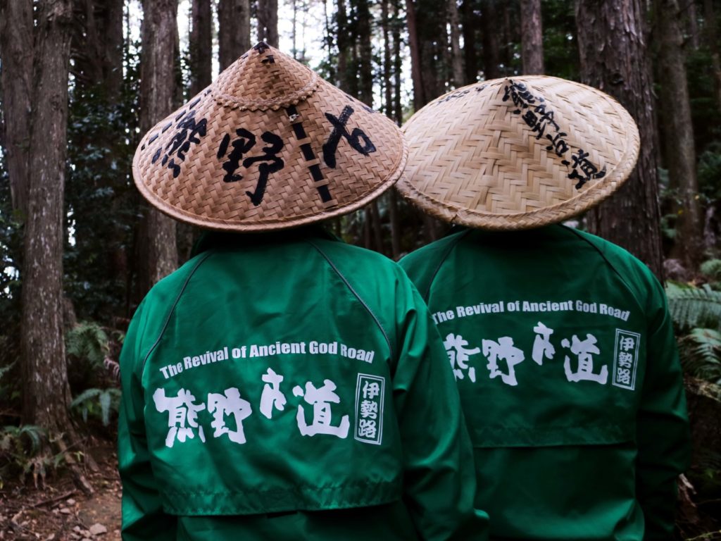
Much of the Iseji Route is paved with stone, making it one of the most unique and atmospheric sections of the Kumano Kodo. Sometimes called the “Eastern Route,” it traces the eastern edge of the Kii Peninsula, starting in Ise and looping round in a “J” to end up at Hayatama Taisha just around the river bend of the Kumano-gawa.
Traditionally, pilgrims would first visit Ise Jingu, then change into white burial robes and straw sandals to follow the path of rebirth, crossing through terraced rice paddies, densely-forested mountains, bamboo groves and long stretches of silver and white beaches. After reaching the Kumano Sanzan, they would continue on the Saigoku Kannon pilgrimage through western Japan.

Nowadays, travelers typically overlook the Iseji Route for the more famous Wakayama trails, ticking off the Kumano Sanzan in a mere few days — along with the busloads of other tourists.
The Iseji Route presents a rare chance to immerse yourself in an experience much closer to that of the original pilgrim’s thanks to its relative obscurity and a reassuring lack of development in the area.
A quick rundown of each of the 20 routes
There are approximately 20 walking routes or passes, in total, each varying in sights and terrain, length and difficulty level. This user-friendly Kumano Kodo Iseji Navigator links a description of each of the routes to Google maps, making it easy to get an overview of how they are connected.

You don’t have to do every single route on the hike, starting at Ise Jingu and ending at Hongu Taisha. This is the fun part about the Kumano Kodo Iseji Route: It’s a real pick and mix of trails, sightseeing and relaxing that you can customize to suit your abilities and interests.
Also, note that this is not a long distance thru-hike. You’ll be getting on and off the mountainside and coastal paths, dipping into Japanese hospitality in the towns and cities of Higashi Kishu.
| Pass Name | Distance | Duration | Difficulty Level | Highlights |
| Meki-toge Pass | 1.8 kilometers | 45 minutes | Easy | This is the first pass of the Iseji Route |
| Misesaka-toge Pass | 2.2 kilometers | 1 hour | Easy | The peaceful Takihara Shrine at the entrance |
| Nisaka-toge Pass | 7.5 kilometers | 2.5 hours | Easy | The spectacular view from Okimi-daira Viewpoint |
| Tsuzurato-toge Pass | 9.5 kilometers | 4 hours | Difficult | Your first glimpse of the Sea of Kumano in the distance |
| Ikkoku Hirakata Miura-toge Pass | 7.6 kilometers | 3 hours | Easy | Gorgeous views of fishing villages along the coastline |
| Hajikami-toge Pass | 3.5 kilometers | 1 hour 50 minutes | Medium | The beautiful view of small islands along with the Kumano ocean |
| Magose-toge Pass | 5.2 kilometers | 2 hours 45 minutes | Medium | The beautiful stone paved roads |
| Crossing Mt. Yakiyama | 10.1 kilometers | 5 hours | Difficult | Steep ascent and descent makes for a welcome challenge |
| Miki-toge Hago-toge Pass | 6 kilometers | 3 hours | Medium | The impressive stone fence built to keep out boars, preserved from 300 years ago |
| Sone-jirozaka-tarozaka Pass | 5.7 kilometers | 3 hours | Medium | The somber graves of pilgrims |
| Nigishima-toge Okamizaka-toge Pass | 4.6 kilometers | 3 hours | Medium | The atmospheric moss-covered route |
| Hadasu-no-michi Pass Route | 4 kilometers | 1.5 hours | Easy | Jofuku Shrine (see itinerary below) |
| Obuki-toge Pass | 4 kilometers | 2 hours | Easy | The peaceful bamboo grove pathway |
| Kannon-michi Pass Route | 3.8 kilometers | 1 hour 40 minutes | Easy | 33 miniature Kannon stone statues |
| Matsumoto-toge Pass | 4.1 kilometers | 1 hour 45 minutes | Easy | The view of Shichirimihama beach and the breathtaking coastline of Kumano-nada |
| Yokogaki-toge Pass | 5.4 kilometers | 2 hours 10 minutes | Medium | The stone path made from lava stone |
| Fuden-toge Pass | 4.1 kilometers | 1.5 hours | Easy | Rice paddies and mountain villages |
| Tori-toge Pass Maruyama Senmaida | 6 kilometers | 2 hours 20 minutes | Medium | The iconic Maruyama Senmaida |
| Hama-kaido Route (North) | 12.2 kilometers | 4 hours | Medium | Long, flat road with the sea view |
| Hama-kaido Route (South) | 14.4 kilometers | 5 hours | Medium | The final part of the Iseji Route where you’ll land on a beautiful beach home to sea turtles |
When to go
Southern Mie has a warm climate that allows citrus fruits like dekopon (mandarin) and Meyer lemon to thrive. Winters are crisp and blue-skied, with temperatures rarely falling below 5 degrees Celsius. On the flip side, the summer is when humidity is at its stickiest and mosquitoes’ favorite time of year to plague would-be pilgrims crossing through.

The best time to hike the Kumano Kodo Iseji Route is therefore in the winter and early spring — roughly late November to mid-April. I hiked at the beginning of December and, while summits were chilly, most of the time I could get away with two layers and a windbreaker. Trails like the Magose-toge Pass and the Hadasu-no-michi Pass get a lot of sunlight. Others are more densely forested. None are so high as to require crampons or other snow gear.
One word of warning, though. Owase City experiences one of the heaviest rainfalls in the world at 3,850 millimeters on average per year. You’ll need to be sufficiently prepared for this!
What to pack

Moving between rocky terrain, sandy beaches, and towns, you’ll need all-rounder gear for day hiking as well as your clothes and toiletries for the night’s stay in a hotel or ryokan. The following should cover your needs:
- Multiday hiking backpack with rain cover
- Lightweight hiking boots or trail runners
- The stone paths can get slippery in the rain so bring shoes with the proper grip and movement
- Rain jacket/windbreaker
- Be prepared for rain
- Water and food
- You’ll be able to replenish your supplies back in town
Example itinerary: Express (4 days)
This express itinerary for the Kumano Kodo Iseji Route is based on my own four-day trip from Tokyo in early December 2018. It’s designed to cover the main highlights and provide a mix of activities (hiking and non-hiking) to accommodate different types of travelers and/or those with limited time.
Day 1: Nagoya to Washige

From Nagoya, take the Limited Express Wideview Nanki train to Owase station (¥6090). It’s small with few facilities so be sure to pack supplies before then. You can take a taxi or bus to Washige Bus Stop (20 minutes). Just opposite the stop is the entrance to the Magose Toge Pass, heralded by a big sign. You can’t miss it.
The Magose-Toge Pass should take around 2.5 hours to complete. However, the winding stone pathway here is extremely photogenic — I must have stopped 20 times to take the same photo of sunlight filtering through the towering hinoki (cypress) trees.

On the way, you’ll pass several jizo, statues of the god of travelers and children. The laughing faces of the jizo were supposed to encourage tired pilgrims to push on.
Keep climbing and you will reach the top of Mt. Tengura. Here you’ll arrive at one of the oldest sites for shugendo or mountain asceticism — marked by a simple shrine. To the left is a rocky outcrop that drops sharply away to air below. You have to climb on a narrow ledge to the farthest point from where you can get an epic, if hair-raising, view of Owase and the ocean beyond.

To the right, an iron ladder clings to a giant boulder that represents one of the mountain kami. Climb up here to snap your official “I made it!” pic.
On the way back down you’ll pass more jizo, as well as picturesque sunlit clearings (I restrained myself) and come out at the exit at a small temple next to a waterfall.
From here you can walk back to Owase and explore the highlights at sea level, including Owase Shrine which hosts the hilarious “quarrelling” festival in early February where groups of men shout and run into each other. Because, why not?
Another popular hike in the area is up to Mt. Binshiyama which has an oh-so Instagrammable summit point shaped like the back of an elephant. More breathtaking nature comes in the form of the crystal clear Choshi River and Uotobikei Ravine nearby.
Accommodation:
Budget-conscious travelers will be happy with Hotel Viora, a business hotel with decent breakfast in the center of town. There is also camping at Camp Inn Miyama beside the Choshi River.

Day 2: Owase to Kata
In the morning stop by the Kumano Kodo Center (open from 9 a.m.), an extraordinary building made from 6,549 local Owase hinoki trees which acts as a tourism and cultural activities hub for the Iseji Route. Not much of the information is presented in English, aside from a short movie, but it’s worth visiting just to marvel at the architecture.

From here, you can take the short walk over to the trailhead for Mt. Yakiyama, said to be the most challenging pass along the Iseji Route. During the Edo period, Yakiyama had a reputation as a treacherous pass filled with bandits and wolves — not to mention a steep and extremely winding ascent — ready to end your journey forever. These days, locals tend to offer the few visitors up for the challenge a hearty “ganbatte!” (“do your best!”) and send them on their way.

As it turned out, Mt. Yakiyama was only moderately difficult and those with an average level of fitness (able to jog a 5K) should be fine. The only potentially unnerving aspect is the fact that you might not come across any other people the whole day.
Coming back down from Mt. Yakiyama, after passing rice paddies with the sun just starting to set in the distance, you’ll eventually emerge from a sleepy residential road onto Mikisato Beach, a gorgeous stretch of pristine sand marking the boundary between mountains and sea. There are some interesting driftwood sculptures you can check out here.

Accommodation:
Owase Seaside View is a pleasant ryokan (traditional Japanese inn) with an oceanside hot spring that’s further from the city’s center but close to Kata station.
Day 3: Kata to Atashika
The next day, take the dinky local Kisei Line train from Kata station to Atashika station (10 minutes).

From here, signs will lead you along a road facing the sea until you reach a collection of houses in a bay pocket hugging the mountainside. Follow the path around and up to find the trailhead to the Hadasu-no-michi Pass.

Hadasu-no-michi is short and sweet but no less cinematic than the preceding walks. The path is lined with paving stones from the Kamakura period recognizable by their large size compared with the Edo period paths. After about an hour or so you’ll reach Jofuku Shrine, dedicated to the famous royal doctor Jofuku who served Qin, the first emperor of China 2,200 years ago and came to Hadasu in search of the elixir of life. (Sadly he didn’t find it).

Next I headed straight for Kumano City by the same Kisei Line train (7 minutes, via Kumanoshi station) but if you have more time you can check out either the Obuki-toge and Kannon-michi walks which lead from Hadasu to Odomari station one stop before Kumanoshi station.
In Kumano City, get back on the route via the Matsumoto-Toge Pass, a popular pass thanks to its accessibility. Much of the stone path laid during the Edo period is intact here and at the top is a gazebo with an awesome view of the Unesco-listed Shichirimihama beach — where sea turtles come to lay eggs from May to August — stretching all the way into Wakayama Prefecture.

Spend the rest of the day exploring the World Heritage offerings of Kumano City with a rental cycle which you can pick up at the quaint Tourism Information Center opposite the station.

It’s easy enough to bike between the main attractions of Hanano-Iwaya, Japan’s oldest shrine, Shishi Iwa (“Lion Rock”) and Onigajo — a spectacular rocky alcove shaped like a demon’s (oni) mouth. Recently, Onigajo has established something of a reputation for being a captivating place for stargazing. Make your way there after dark for a view like this:

Accommodation:
For the last night, I went fancy with a stay at the luxurious Resort Kumano Club, a tiered complex of private ryokan rooms set into a hillside that is so big it has its own shuttle bus for guests to venture between the several restaurants, spa, and reception.
Day 4: Kumano City and Maruyama Senmaida Rice Terraces

Resort Kumano Club offer a cheap guided tour to the Tori-Toge Pass and Maruyama Senmaida early morning (¥2500, departing 8 a.m.). From the top of the Tori-Toge Pass, you get a jaw-dropping view of the iconic Maruyama Senmaida and are then led down to stand among the rice paddies themselves.

There were just a couple of farmers when I was there but they let us walk around and take pictures. My guide told me that each of the paddies is patronized by somebody, not necessarily a farmer, and every year all of the patrons gather from all over Japan to tend to the fields during harvest time.
After the tour head back to Kumano City. If you’re short on time or need a change of pace you can pick up a car or taxi to explore the Hongu-michi Kawabata-kaido Route Drive Course.

Driving towards Wakayama Prefecture there are several interesting stops. Mentioned above, Shichirimihama is Japan’s longest beach and also a place to spot loggerhead turtles laying their eggs from May through September. Slightly inland is Hisetsu Falls, a waterfall that looks like hanging threads of silk. Right next to it is the Hisetsu-no-taki Camping Ground, a hugely popular campsite in the summer with wooden cabins and ample space for tents.

Here you’ll also find the Kumano-gawa river from where you can catch a traditional three-sail riverboat and travel the few hundred meters into Wakayama to see Hayatama Taisha set back inland at the curve of the riverbed before it flows out to the sea.
The last Wideview Nanki train is at 5:50 p.m. which will have you back in Nagoya by 9 p.m. or Matsusaka by 8 p.m. (see “How to get there and get around” below).
Traditional itinerary (2 weeks)
From beginning to end, a full tour of the Iseji Route should take about two weeks or more with a couple of diversions thrown in. Check out this nice itinerary of the Kumano Kodo Iseji Route on travel blog Aussie on the Road or these alternative itineraries on the Kumano Kodo Iseji Route official blog.
How to get there and get around
Access will depend on your start point. If you are beginning at Ise Jingu, Iseshi station is the closest to the Ise Jingu, served by Kintetsu Railway from Nagoya, Kyoto and Osaka stations.
In Higashi Kishu, the main access points are Kii Nagashima station, Owase station, and Kumanoshi station. All three are served by the highspeed JR Limited Express Wideview Nanki train via Nagoya (if you’re coming from Tokyo) or Matsusaka station (if you are coming from Kyoto or Osaka).

The further south along the Iseji Route you go, the harder it is to get around with public transport. There are some buses but they travel sporadically. However, since the towns are located fairly close to each other you can always get from pass to pass in the pilgrim’s way — on foot.
For transport information in and around the Iseji Route, it’s best to refer to each of the town’s own tourism websites:
Kiho Town
Kumano City
Mihama Town
Kihoku Town
Owase City
Where to stay
In each of the towns and cities you’ll be passing through, there is a decent range of options for varying budgets. You can see the hotels we stayed at in the 4-day itinerary example above. Airbnb has some interesting listings too, including a couple of atmospheric farm stays.
What to eat

All that exercise deserves to be rewarded with some of the local gourmet highlights. While each town and city has its own culinary flavor, there are a few dishes that you shouldn’t skip out on while you’re on the Iseji Route.
- Mehari-zushi: A local’s favorite of pickled Pacific saury on top of rice wrapped in mustard leaf.
- Akafuku mochi: A popular souvenir from Mie Prefecture is this mochi (pounded rice cake) topped with adzuki bean paste meant to resemble the flow of the Isuzu River.
- Mikan: These super sweet mandarin oranges are harvested in Mihama Town.
- Mahata: Owase City is Japan’s largest produced of mahata, a rare and delicious fish that’s good for sashimi.
- Mikumano-gyu and Kumano-jidori: Top-notch beef and chicken farmed in Kumano City.
- Watari Kaki: A rare and meaty oyster from Kihoku Town.
Resources and guides
For more information on hiking the Kumano Kodo Iseji Route, take a look around the multilingual website: kodo.pref.mie.lg.jp.
Local guides are available. Please check this website or ask at a tourist information center in the area to be referred. My guide during the trip was the super knowledgeable, and hilarious, Kawamura-san. You can DM her in English on Instagram @shiba.rinrin and she’ll either guide you or connect you with someone who can.


This site is protected by reCAPTCHA - Privacy Policy - Terms of Service